Ottawa, Illinois learned how to keep its residents out of harm’s way. But on the river’s edge, safety has often required sacrifice.

- Climate change and upstream development made the riverfront town of Ottawa, Illinois even more prone to flooding.
- Unlike many communities nationwide, it has successfully neutralized the threat by steering development out of floodplains.
- The town crystallizes difficult truths of climate adaptation: that safety requires constant vigilance and, often, immense personal sacrifice.
By Laura Gersony, Circle of Blue — September 17, 2021
For 30 years, Dean Anderson’s home was his pride and joy. A small riverfront property at the confluence of the Fox and Illinois Rivers in Ottawa, Illinois, the house held some of his happiest memories. Anderson remembers spending weekend mornings with his wife, who has since passed away, enjoying the view of the docks he built on the river.
“We loved that house. We’d go out in the morning and drink coffee out on the deck,” he said. “It was so quiet, you could hear the fish jump.”
So deep was Anderson’s love for his home that he was willing to endure the floods that had long plagued the neighborhood, an area known in town as “the Flats.” In the mid-90s, climate change and upstream development funneled more runoff than ever into the already flood-prone area. This reached a peak in 1996, when waters infiltrated Anderson’s already-elevated home twice in one year.
The city began offering to buy out homes in the Flats, using funding from FEMA, so that residents could relocate to safer areas. Anderson, for his part, refused the city’s offers several times. “We’d just gotten the place fixed up the way we wanted,” he said. “We planned on staying there the rest of our lives.” It wasn’t until 2000 that Anderson relented, concerned about the effects of contaminated floodwaters on his ailing wife’s health.
That buyout program marked the beginning of a decades-long flood management strategy in Ottawa. It steered development out of the riskiest areas. It bought out 50 flood-prone properties and moved homeowners out of the flood plain. Ottawa tightened the safety requirements for buildings located in flood zones. And, unlike many places, it strictly enforces FEMA’s “50% rule,” mandating that buildings become compliant with local floodplain building codes when they accumulate damage worth half its original value.
Those steps worked. Last year, the second-highest flood on record caused virtually no property damage citywide—a stark contrast to the devastation floods used to wreak.
But behind the town’s successes lie personal sacrifice. Today, settled into his new home further inland, the memory of Anderso’s life in the Flats makes his heart ache. “I miss it still,” he said.
Anderson’s bittersweet experience is not unusual in the town, where safety has always come at a steep cost. It’s a place that crystallizes the glaring truths of living with climate change. In Ottawa, every resident relocated to safety is a life turned upside down. And the city’s experience shows that in an increasingly volatile climate, achieving safety is not an endpoint; it is a continual way of life.

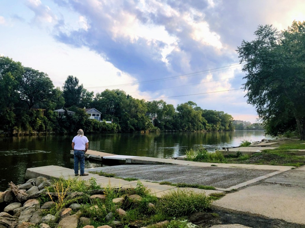
Dean Anderson remembers selling his home as one of the hardest decision he ever made. Photo © Laura Gersony / Circle of Blue
Flooding has always been a part of life in Ottawa. The city receives the runoff from the Illinois and Fox River watersheds, which have a combined area of almost 12,000 square miles. Heavy rains upstream can flood the town—even if local rains are minimal. Bob Eschbach, the mayor from 1999-2019, recalls how, in his youth, people would take small measures to protect themselves.
His father would wedge a basketball in the toilet and a hockey stick in the basement drain to prevent flooding. Back then, flooding wasn’t an existential threat. “It was a degree that people could live with; the flooding wasn’t as frequent, and it didn’t seem to be as severe as it is now,” Eschbach said.
That would soon change. Since Eschbach’s youth, climate change has made the heaviest rainfall events almost 40% more intense in the Midwest and, in many places, more frequent. What’s more, urbanization and development upstream of Ottawa have turned water-absorbing ecosystems into impervious roads and parking lots, funneling even more runoff into the city’s riverbanks.
Lifelong residents watched as the flooding became too dangerous and frequent to ignore. Dave Noble, Ottawa’s director of economic development, recalls that during these years, whenever heavy rains hit northern Illinois, Chicago news agencies would send their helicopters straight to Ottawa. “They knew there would be houses underwater, people being rescued by boats, and it would be a great news story,” Noble said.
Nationwide, at this point, the cost of floods began to escalate. In the 90s, flooding caused $5 billion in damage in the U.S. In the 2000s, that figure doubled to $10 billion. And last decade, it doubled once again, amounting to $20 billion.
During those same decades, however, the opposite occurred in Ottawa. In 2020, the city experienced its second-highest flood on record. It was water off a duck’s back. “We had to close some streets that were underwater, but we had no businesses damaged, no houses damaged, no schools damaged,” Noble said. “Instead of walking away with tens of millions of dollars of damage, we effectively had just a little bit of maintenance and cleanup. That’s a success.”
Ottawa is one of only six communities nationwide to have achieved the second-highest possible rating under the Community Rating System, the Federal Emergency Management Agency’s measure of floodplain safety. “No one can stop flooding, but Ottawa has taken steps to minimize and mitigate their severe damages,” said Connie Brooks, the 12-year director of the county’s Emergency Management Agency. “There’s no more life safety issues. No other area in the county has done that; they are well ahead of the curve.”
The Flats buyout program was key to achieving this goal. The city bought homes for 80% of their market value before the floods, allowing most residents to stay on their feet financially when relocating. Nancy Stisser, who was one of the project’s managers, described how it opened up a world of possibility for people who likely wouldn’t have been able to sell their homes otherwise, due to flood damages. “We helped a lot of people,” Stisser said. The area is now a public park. By one estimate, buyouts have saved the city over $9 million in damages.

The city bought vulnerable riverside properties as part of the Flats buyout program. Photo courtesy of the City of Ottawa.
From a safety perspective, residents and city officials view it almost universally as a success. For many residents, like Randy Jacobs, participating was a “no-brainer.” After the two major storms in ‘96 and ‘97, Jacobs remembers how his wife would pace the floor whenever it rained, anxious that the floodwaters would flow into their home once again. “The writing was on the wall,” he said. “It just got to a point where it wasn’t worth it to stay.”
But these decisions, Stisser remembers, were often fraught with grief. One of her jobs was explaining the program in one-on-one conversations with qualifying residents. She met a daughter, forced to sell the home she was born in; a mother who could no longer carry her disabled child up and down the stairs to reach their elevated home; a grandchild who had to kiss a beloved riverfront tire swing goodbye.
Stisser is acutely aware of how every resident relocated also represents a life upended. “Everybody has a story. You have a story, I have a story. And the people that lived in this area had a story, too; each of them,” she said.
“On the one hand, you’re so excited for this person for the opportunity they were given,” she said, “but you’re sad on the other, because you know that they really don’t want to give up what they worked for, or the place they spent their lives.”
This ambiguity is built into life on the edge of a changing climate; and it’s a dynamic that the city’s planning is designed to uphold. Ottawa strictly enforces the “50% rule”: a FEMA mandate requiring that when a building accumulates damage worth 50% of its original value, it has to become compliant with local floodplain building codes. It’s rare for cities to strictly enforce the rule; both because they don’t want to discourage development within their limits, to keep their tax base intact, and because it’s viewed as placing yet another burden on flood victims—in Berginiss’ words, “kicking people while they’re down.”
But in many places, these sacrifices are key to successful flood management. “A lot of people like the catchy slogan, ‘build back better.’ But a lot of them sure don’t like to enforce that slogan, and do the hard work of what that actually means,” said Chad Berginnis, the director of the Association of State Flood Plain Managers.
Mathew Stafford, the city’s floodplain manager, said that this messaging is gradually working its way into the city’s collective consciousness, especially since the damages are so visible. “We have implemented a lot of strict requirements in our ordinances; but it’s pretty easy to tell the story of, ‘this happened last year, this happened two years ago,’” he said. “People are getting it: it’s not a good idea to build here.”

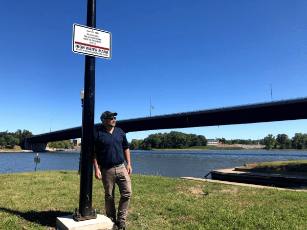
Mathew Stafford, the city’s floodplain manager, stands in front of a sign displaying the record flood in 2013. Photo © Laura Gersony / Circle of Blue
On higher ground, residents like Anderson are now safe. But the development trends that have made the city so vulnerable still remain. So the question looms: how much longer will Ottawa’s flood protection measures hold?
It’s a question that looms over Stafford when signing off on a building permit. He often urges developers to go beyond the minimum safety requirements, knowing that federal flood codes can be out of date even by the time they’re issued. “With all the rains, and what’s been happening, you just don’t know if that’s going to be enough,” he said.
Just as flood risks evolve, however, so too do Ottawa’s mitigation plans. Flood adaptation in the city is not designed to have an endpoint. Rather, by continually enforcing the 50% rule and tightening building codes, it’s an ongoing process, a constant cycle of risk assessment and reassessment.
Berginnis said that this is necessary for an effective flooding program. “Flood mitigation is not a one-and-done type activity. Not only is it multi-year; oftentimes, it’s multi-decadal,” he said.
Ultimately, the city’s history is a testament to its ability to adapt, even if for no other reason than necessity. “Residents would take on severe repetitive loss quite frequently, putting peoples’ lives in jeopardy,” Brooks said. Looking back at the buyout program, “I think that vulnerability was the biggest motivator.”
Residents of Ottawa, especially those on the front lines of flooding, know this firsthand. In the thirty years before Anderson sold his property, he was constantly adapting to the changing river levels. After historic flooding hit in the early 80s, Anderson paid to elevate the house on eight-foot stilts. Later, he built a stone floodwall into his yard to fend off rising waters. And over the years, the couple learned they could never plant a garden, as their plants would get swept away with heavy rainfall. In spite of all this, “god dammit”: the place was his home.
“We was fightin’ as long as we’d been there,” he said. ”But I miss it still.”

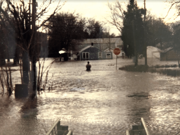
Historic flooding that devastated the Flats neighborhood in 1983. Photo courtesy of Dean Anderson.